

3D Terrestrial Laser Scanner
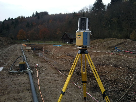
We are equipped with a terrestrial 3D laser scanner to produce high-resolution 3D models of objects of our interest. The scans of each station, give local coordinates for a large set of object points. An overlap of few targets between successive or adjacent scans enables us to bring all the scans in an identical coordinate system.
The maximum scan rate of our Topcon GLS-1000 scanner is 3000 Hz. Scan accuracy and resolution depend on reflectivity and distance. We have achieved resolutions of less than one centimeter. In good sky visibility, we use the kinematic GPS, real-time or post-processing for geo-referencing of our scans. Total station is the alternative in poor sky visibility.
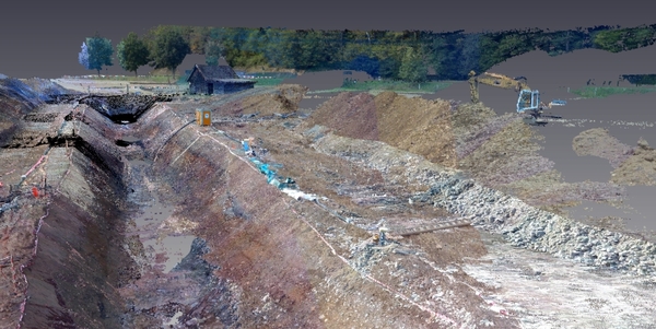
Laserscan of paleo-seismology trench